Interactive map charts Scenic Rim's ongoing flood recovery journey
An interactive map will provide information on the location and progress of roadworks as the Scenic Rim continues its flood recovery journey.
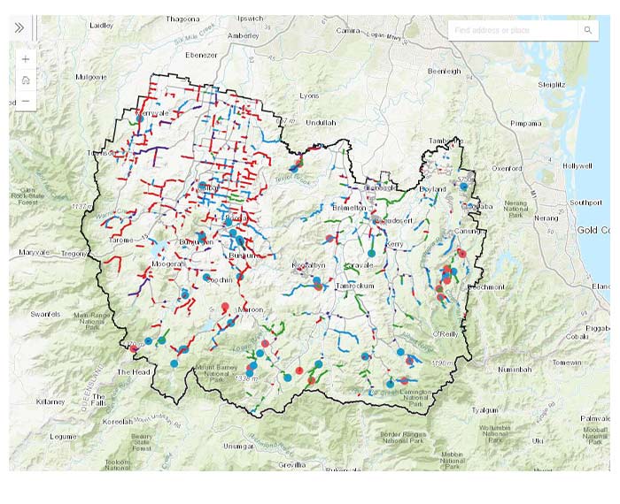
The map, which can be viewed on Council's website at www.scenicrim.qld.gov.au/roadworks will show, at the click of a mouse, the description and location of flood damage on the local road network and the status of repair works.
Scenic Rim Mayor Greg Christensen said the map would be updated as works progressed.
"Supported by the Australian and Queensland Governments through disaster recovery funding, we have a lot of work, in different stages, going on across our region," he said.
"This map puts at users' fingertips information about works which have commenced, those that are waiting further approvals and works which have been completed.
"It reflects the long journey of recovery from disaster events which have impacted our region over a number of years, most recently the flooding of early 2022."
Further information on Council’s ongoing flood restoration program is available at www.scenicrim.qld.gov.au/get-the-facts
Assistance for these works has been provided through the jointly-funded Commonwealth-State Disaster Recovery Funding Arrangements (DRFA).