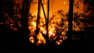
Hazard Reduction Program Targets Bushfire Risks
More than 350 Scenic Rim properties and 2600 hectares of natural area will be better protected from bushfire following a targeted area hazard reduction program which began in February.
The Bushfire Risk Reduction Project has been funded by Council and the Queensland and Australian governments under the Natural Disaster Resilience Program, which aims to address specific risks faced by local communities.
Mayor Greg Christensen said that, by the project's completion at the end of March, Scenic Rim properties and residents, the region's natural areas and firefighters would be better protected from the threat of bushfires.
"Reduction of fuel loads, through slashing and burning of vegetation, is just one facet of this program which is contributing to safer, more sustainable communities and the protection of the natural assets for which the Scenic Rim is renowned," he said.
"As part of the Bushfire Risk Reduction Project, more than 19 kilometres of new fire trails have been constructed and more than 22 kilometres of existing fire trails maintained.
"This will ensure that, in the event of a bushfire, firefighting crews have greater access to fire zones and, more importantly, safer exit routes," he said.
Bushfire hazard reduction works have already been carried out at Tamborine Mountain, Guanaba, Tamborine, Veresdale, Boyland, Biddaddaba, Gleneagle, Beaudesert, Boonah, Kooralbyn, and Aratula.
Controlled burns scheduled for this month at Walker Drive, Kooralbyn; Campbell Drive, Kooralbyn and Camphor Drive, Boyland are dependent on weather conditions.
"Although the Scenic Rim has been affected by a series of severe wet weather events which have resulted in flooding in recent years, we also need to be aware of the risk of bushfire in our region," Cr Christensen said.